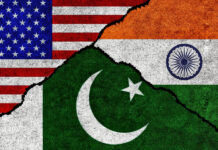
The Ministry of Information and Broadcasting has issued an advisory to all private satellite television channels to only use the latest political map that depicts the newly-created Union Territories of J&K and Ladakh and is approved by the Survey of India in their news reports. On the creation of two Union territories of Jammu & Kashmir and Ladakh on October 31, the new political map of the country has been released on November 2, said the I&B ministry order dated November 18 and made public on Thursday. “The political map has been prepared by the Survey of India, Department of Science and Technology and is available online. All TV channels are requested to use only the new political map of India henceforth,” it said. The new map was released by the central government on November 2 with Ladakh consisting of two districts – Kargil and Leh, while the rest is the erstwhile state of Jammu & Kashmir.

Dogra Herald is the media of J & K, breaking language and geographical barriers, connecting J & K to the rest of India.
0191 245 4946
info@dograherald.com
Latest articles
PM reminds Congress of dark days of 1975’s Emergency
DOGRA HERALD BUREAUNew Delhi, June 25Prime Minister Narendra Modi on Tuesday took to social media to hit out at the Congress as...
COVID-19 cases reach record high in India
iamjkstarr - 0
NEW DELHI: India recorded an all-time high of 1,03,558 coronavirus infections in a day pushing the nationwide COVID-19 tally to 1,25,89,067, according...
Bajrang Punia nominated for Khel Ratna award
iamjkstarr - 0
Asian and Commonwealth Games gold-medallist wrestler Bajrang Punia was on Friday nominated for the country's highest sporting honour -- the Rajiv Gandhi Khel Ratna...


